
 An INSPATIA Platform

SwiftPlot: Processing & Plan Preparation
The processing engine of SurveyOne. It transforms raw field survey data into accurate, standard, client-ready plans, with validation, automatic arrangement, and smart scale suggestions.
Explore SwiftPlot

SurveyOne is INSPATIA's flagship geospatial platform: one place to process field data, prepare standard plans, and store every job as living spatial data. It houses two solutions that work as one: SwiftPlot for processing and GeoVault for GIS storage.
Inside SurveyOne
SwiftPlot and GeoVault are not separate products; they are the two solutions inside SurveyOne, sharing one workflow so no data is ever lost between the field and the archive.
The processing engine of SurveyOne. It transforms raw field survey data into accurate, standard, client-ready plans, with validation, automatic arrangement, and smart scale suggestions.
Explore SwiftPlotThe geospatial data vault of SurveyOne. It replaces cabinets and scattered folders with a structured, cloud-enabled GIS database that is secure, searchable, and built to last a professional lifetime.
Explore GeoVaultWhy SurveyOne Exists
Every job creates valuable spatial data that should be accurate, structured, retrievable, and analyzable. Yet most work still happens in ways that limit its long-term value.
SurveyOne was built to treat that data as a long-term asset, not a one-time deliverable, useful not only to the professional who created it, but to the government bodies, communities, and everyday users who depend on it later.
Data spread across drives, folders, and cabinets with no unified system.
Hours wasted searching for old jobs and records.
Manual drafting done from scratch for every single job.
Poor long-term preservation puts years of work in danger.
SwiftPlot handles every step of turning raw field data into accurate, standard, client-ready plans, reducing manual repetition and shortening preparation time dramatically.
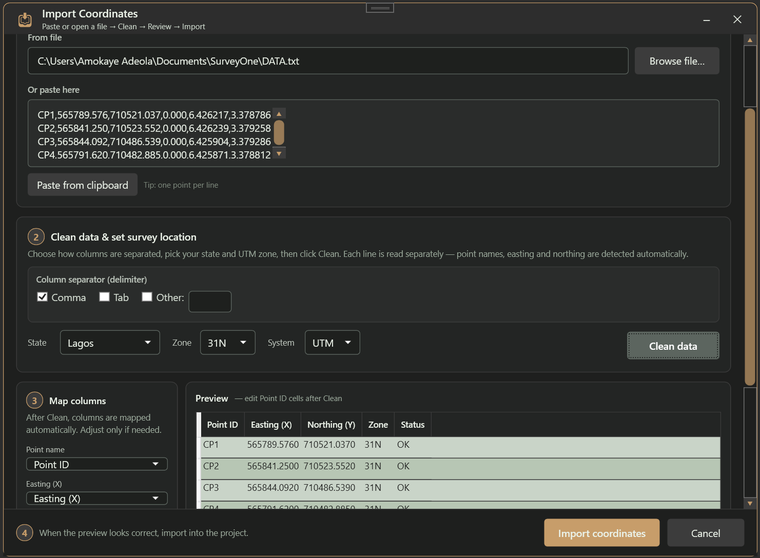
Process raw field data with automated validation and consistency checks built in.
Data is intelligently arranged into standard plan layouts, eliminating hours of manual positioning.
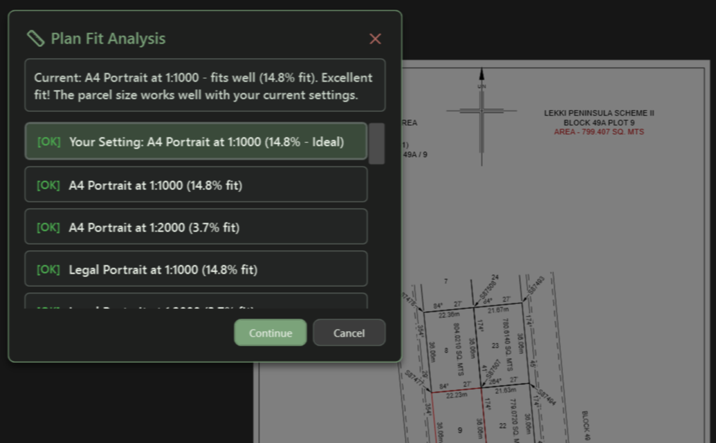
Automatically determines the optimal paper size and scale, with fit-percentage analysis and one-click templates.
Clean, professional layouts applied instantly. Plans need minimal to no manual adjustment before printing.
Automated computations minimize common human errors in coordinates, bearings, and measurements.
Convert data to Shapefiles and Google Earth formats for GIS integration and sharing.


GeoVault replaces cabinet-based storage with a structured, cloud-enabled geospatial database designed for the cadastral environment, turning static files into living spatial intelligence.
Every job stored in a structured geospatial database with 256-bit encryption, not scattered folders.
Find any job from any period. Search by location, client, date, pillar number, or any metadata.
View every job on an interactive map, track boundary history over time, and detect overlaps before they become disputes.
Pillar-number tracking, duplicate detection, a complete audit trail, and role-based access control for teams.
Access your data securely from anywhere with automatic cloud backup and 24/7 availability.
Finish a plan in SwiftPlot and sync it to GeoVault in one click: structured, tagged, and ready for retrieval.
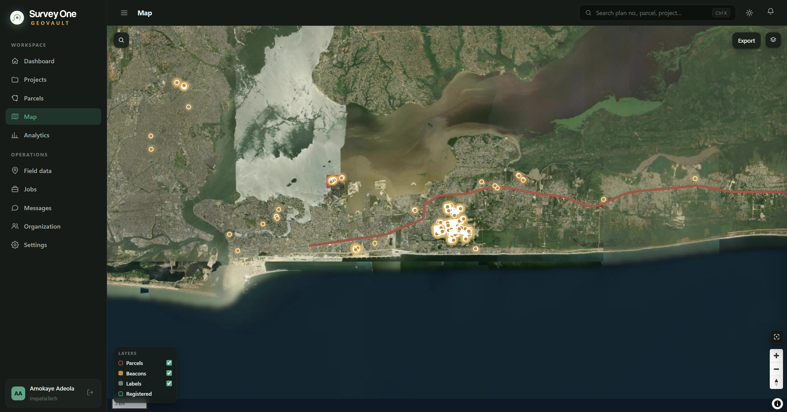
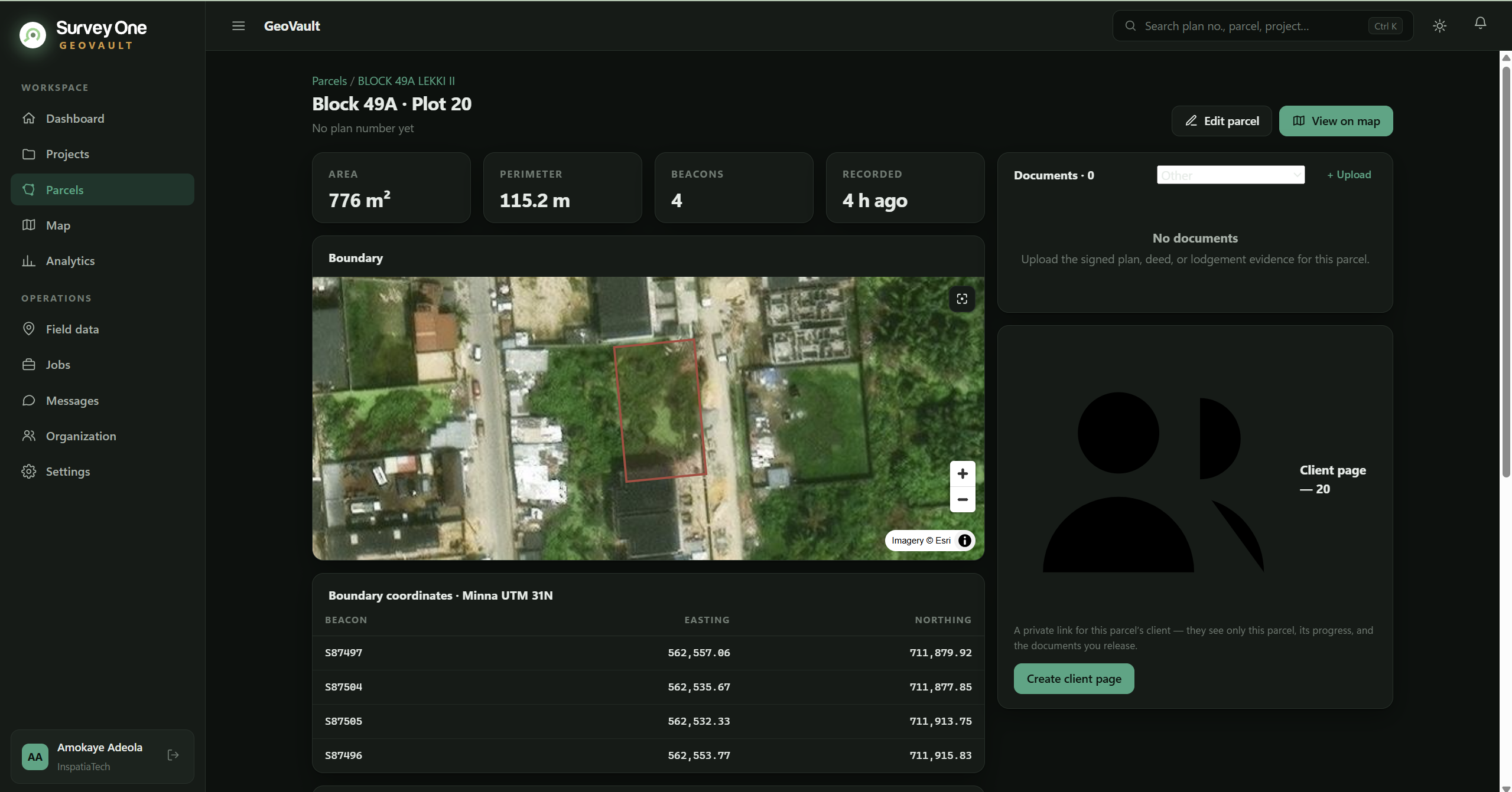
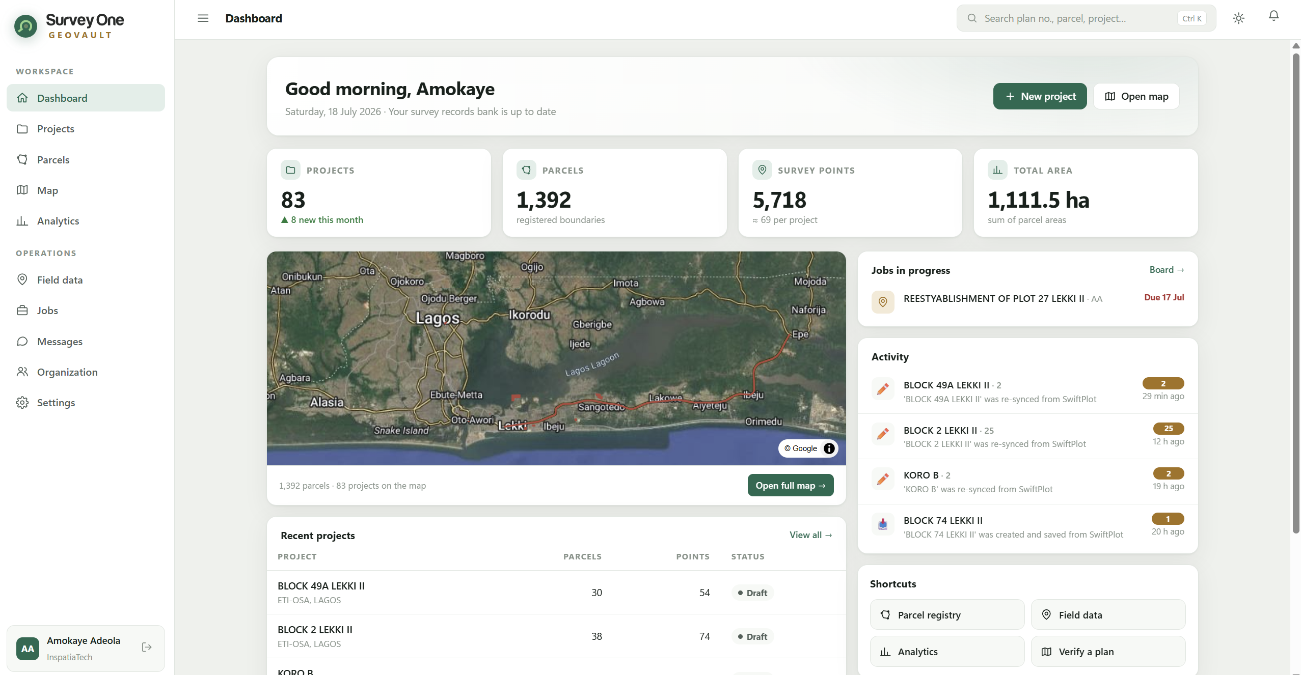
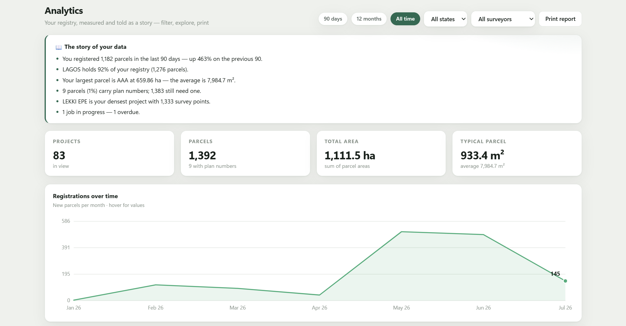
Open the GeoVault web app to create your account, store your jobs, and see your work on the map.
The Workflow
Collect field data with your existing instruments and workflow.
Validate and prepare the data in SwiftPlot with automated checks.
Produce standard, client-ready plans in minutes.
Organize every job in GeoVault's structured geospatial database.
Retrieve, cross-reference, and analyze work across projects and time.
Deliver to clients and export to open GIS formats when needed.
Who It's For
SurveyOne starts with the professional creating the data, but its value reaches everyone whose life touches the land.
Faster preparation, fewer errors, and one archive for every job ever done.
Structured, standardised geospatial data ready for registries and planning.
Reliable ground and boundary data for building, farming, and land-use decisions.
Documented, tamper-proof records that protect land for the long term.
System Requirements
| OS | Windows 10 (64-bit) |
|---|---|
| Processor | Intel Core i5 or AMD equivalent |
| RAM | 8 GB |
| Storage | 10 GB available space |
| Display | 1920 × 1080 |
| Graphics | DirectX 11 compatible |
| OS | Windows 11 (64-bit) |
|---|---|
| Processor | Intel Core i7 or AMD Ryzen 7 |
| RAM | 16 GB or more |
| Storage | SSD with 20 GB available |
| Display | 2560 × 1440 or higher |
| Graphics | NVIDIA GTX 1060 or better |
More Than Software
Work smarter, protect your data, and extract long-term value from every job. Free 14-day trial, no credit card required.